Wednesday 28 August 2024 at 11:44
La Vuelta Ciclista a España '24 / Stage 11
Campus Tecnológico Cortizo. Padrón - Campus Tecnológico Cortizo. Padrón
Classification: 2.UWT - Category ME
The stage
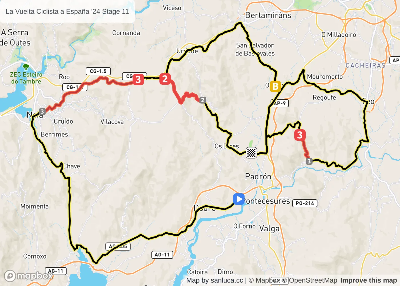
Stage 11 of the 2024 La Vuelta Ciclista a España is a hilly stage that will take place on Wednesday 28 August 2024 at 11:44.The stage starts in Campus Tecnológico Cortizo. Padrón and finishes in Campus Tecnológico Cortizo. Padrón. Start time is 11:44 with an expected finish at 15:31 (average speed of 44 km/h).
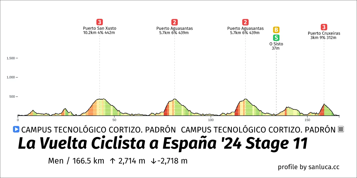
The total distance of the stage is 166.5 km. The stage includes 4 categorized climbs and 1 intermediate sprint. The stage has a total elevation gain of 2714.3 m with the highest altitude of the stage being 446 m. The total descent of the stage is -2718.4 m.
Weather and forecast
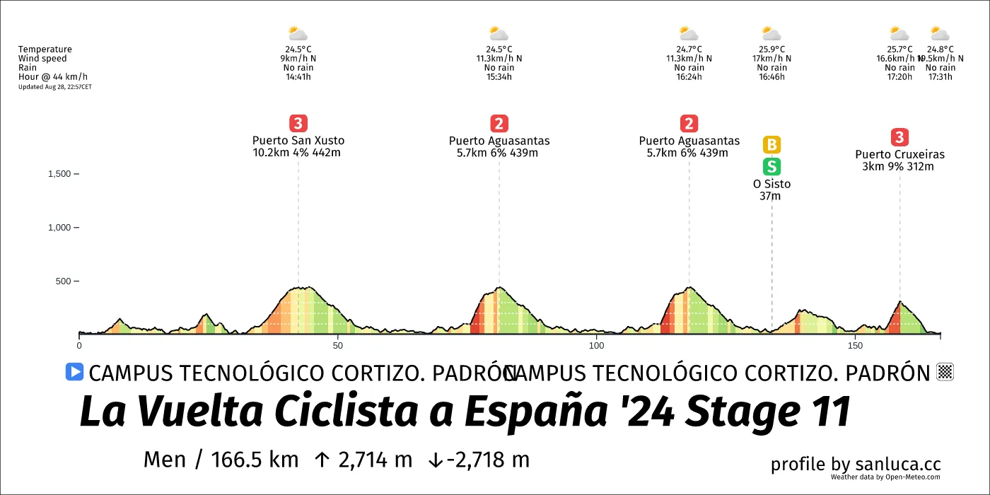
- The race will have temperatures between 23 and 27°C, with an average of 26°C.
- No rain is expected.
- The wind will come mainly from NE, N with an average of 11 km/h wind. The maximum wind speed will be 20 km/h with gusts of up to 46 km/h.
Points of interest
The stage includes 4 categorized climbs and 1 intermediate sprint.
Round About
Round About is a d_round_about at 6.6 km (159.9 km to go).
Round About
Round About is a d_round_about at 6.8 km (159.7 km to go).
Narrow Road
Narrow Road is a narrow_road at 19 km (147.5 km to go).
Bridge
Bridge is a d_bridge at 29.1 km (137.4 km to go).
Bridge
Bridge is a d_bridge at 30.9 km (135.6 km to go).
Round About
Round About is a d_round_about at 31 km (135.5 km to go).
D. Right Turn
D. Right Turn is a d_turn_right at 31.3 km (135.2 km to go).
Narrow Road
Narrow Road is a narrow_road at 31.3 km (135.1 km to go).
Puerto San Xusto
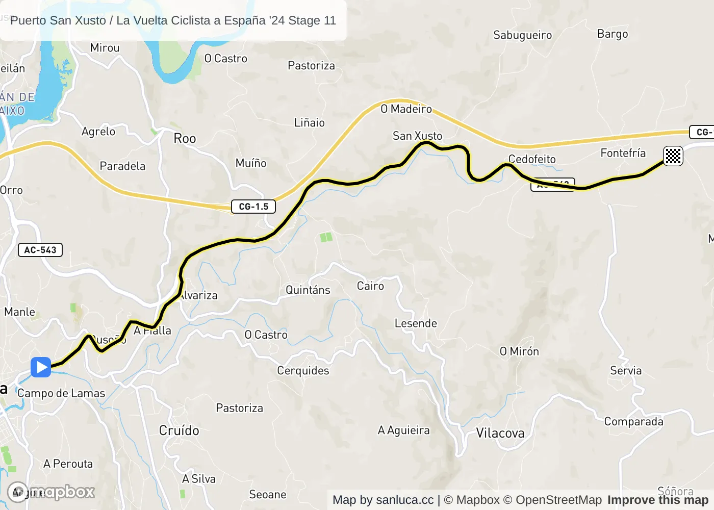
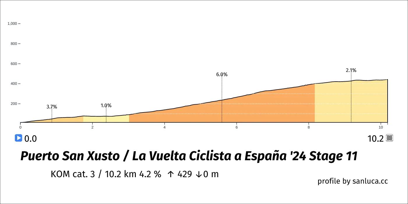
Puerto San Xusto is a KOM cat. 3 climb, which starts at 32.2 km (134.3 km to go) and ends at 42.4 km (124.1 km to go). It has total distance of 10.2 km, and an average gradient of 4.2%, going from 14 to 442 meters of altitude.
Round About
Round About is a d_round_about at 34 km (132.4 km to go).
Round About
Round About is a d_round_about at 35.9 km (130.5 km to go).
Traffic Island
Traffic Island is a traffic_island at 36.1 km (130.4 km to go).
Round About
Round About is a d_round_about at 44.6 km (121.9 km to go).
Round About
Round About is a d_round_about at 48.7 km (117.8 km to go).
Round About
Round About is a d_round_about at 53.6 km (112.9 km to go).
Traffic Island
Traffic Island is a traffic_island at 53.7 km (112.7 km to go).
Round About
Round About is a d_round_about at 53.8 km (112.7 km to go).
Round About
Round About is a d_round_about at 54.6 km (111.9 km to go).
Bridge
Bridge is a d_bridge at 54.7 km (111.8 km to go).
Bridge
Bridge is a d_bridge at 58.2 km (108.3 km to go).
Round About
Round About is a d_round_about at 61 km (105.4 km to go).
Traffic Island
Traffic Island is a traffic_island at 62.3 km (104.2 km to go).
Bridge
Bridge is a d_bridge at 62.7 km (103.8 km to go).
Round About
Round About is a d_round_about at 65.1 km (101.3 km to go).
Round About
Round About is a d_round_about at 66.5 km (100 km to go).
Bridge
Bridge is a d_bridge at 66.7 km (99.8 km to go).
Round About
Round About is a d_round_about at 66.9 km (99.5 km to go).
Bridge
Bridge is a d_bridge at 67.1 km (99.4 km to go).
Round About
Round About is a d_round_about at 68.7 km (97.7 km to go).
Speed Bump
Speed Bump is a speed_bump at 70 km (96.5 km to go).
Narrow Road
Narrow Road is a narrow_road at 70.6 km (95.9 km to go).
Bridge
Bridge is a d_bridge at 71.1 km (95.4 km to go).
Narrow Road
Narrow Road is a narrow_road at 75.1 km (91.4 km to go).
Puerto Aguasantas
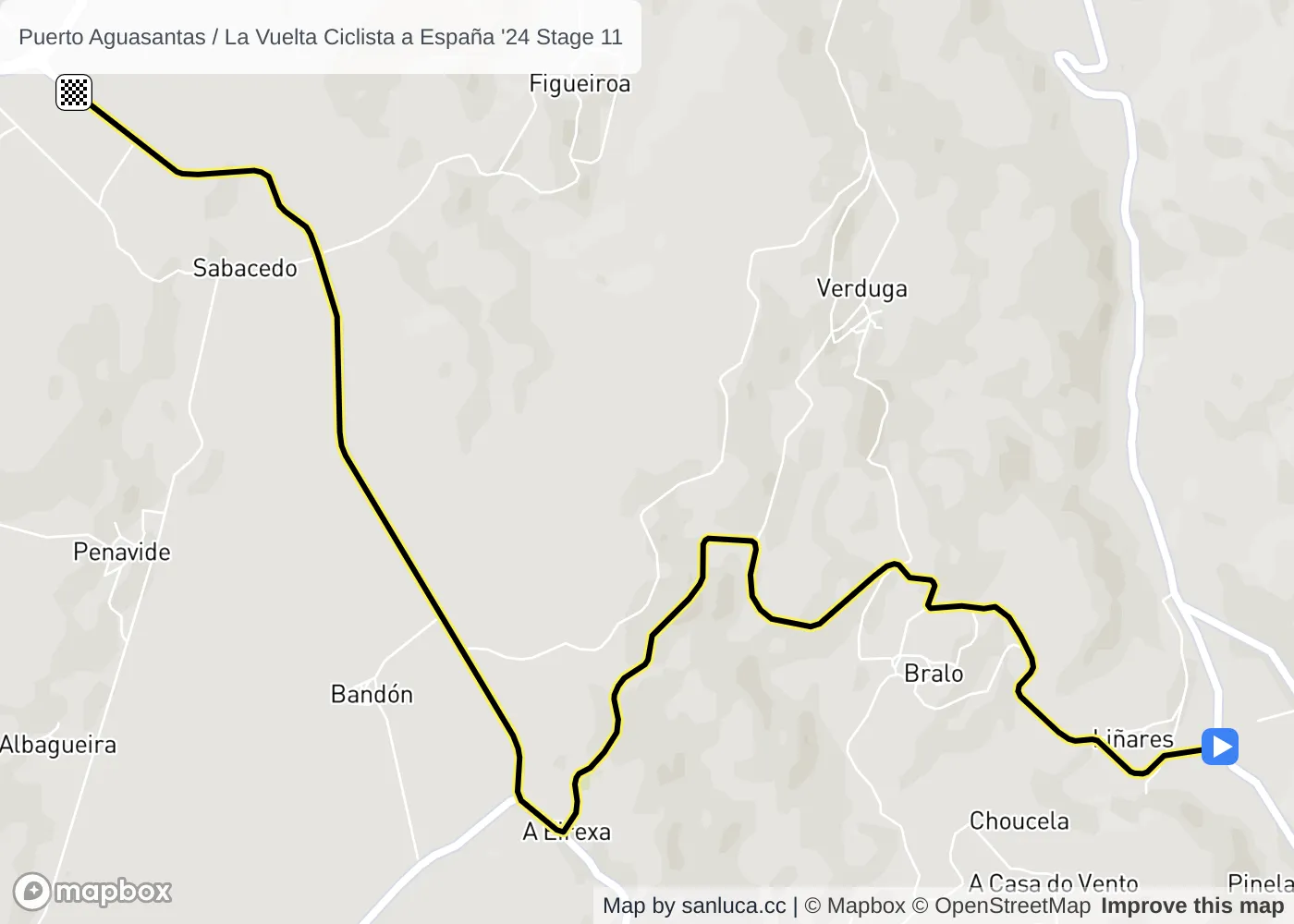
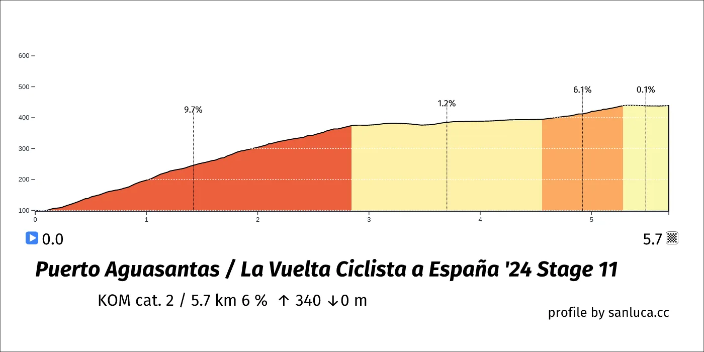
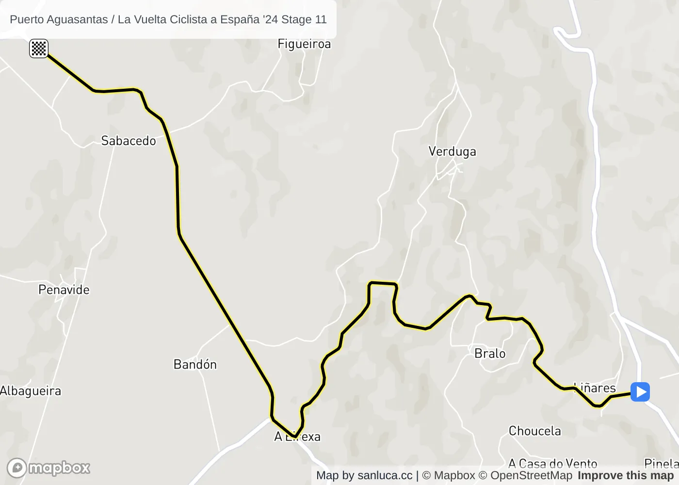
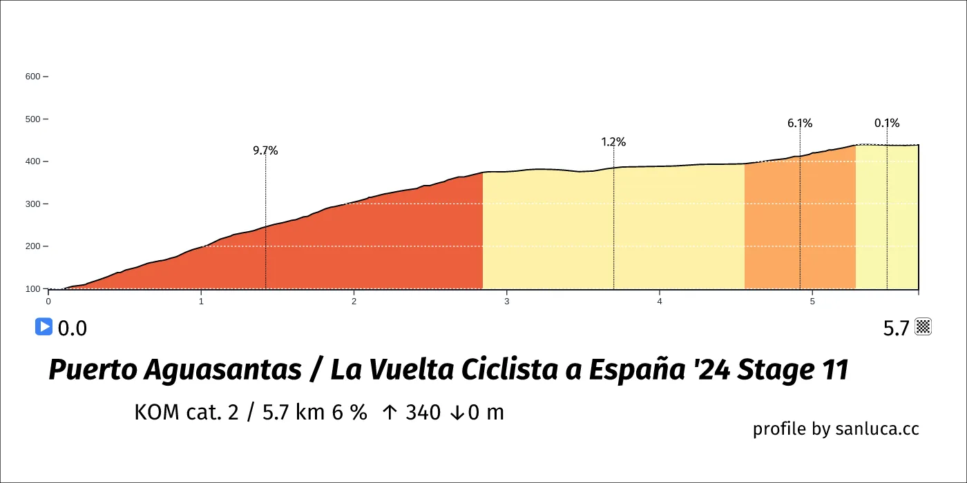
Puerto Aguasantas is a KOM cat. 2 climb, which starts at 75.5 km (91 km to go) and ends at 81.2 km (85.3 km to go). It has total distance of 5.7 km, and an average gradient of 6%, going from 99 to 439 meters of altitude.
Narrow Road
Narrow Road is a narrow_road at 75.7 km (90.8 km to go).
Information
Information is a info at 78.6 km (87.9 km to go).
Round About
Round About is a d_round_about at 85.5 km (81 km to go).
Round About
Round About is a d_round_about at 90.4 km (76.1 km to go).
Narrow Road
Narrow Road is a narrow_road at 90.5 km (76 km to go).
Round About
Round About is a d_round_about at 91.3 km (75.2 km to go).
Bridge
Bridge is a d_bridge at 91.4 km (75.1 km to go).
Bridge
Bridge is a d_bridge at 94.9 km (71.6 km to go).
Round About
Round About is a d_round_about at 97.8 km (68.7 km to go).
Traffic Island
Traffic Island is a traffic_island at 99.1 km (67.4 km to go).
Bridge
Bridge is a d_bridge at 99.4 km (67 km to go).
Round About
Round About is a d_round_about at 101.9 km (64.6 km to go).
Round About
Round About is a d_round_about at 103.2 km (63.2 km to go).
Bridge
Bridge is a d_bridge at 103.4 km (63.1 km to go).
Round About
Round About is a d_round_about at 103.7 km (62.8 km to go).
Bridge
Bridge is a d_bridge at 103.8 km (62.6 km to go).
Round About
Round About is a d_round_about at 105.5 km (61 km to go).
Speed Bump
Speed Bump is a speed_bump at 106.7 km (59.8 km to go).
Narrow Road
Narrow Road is a narrow_road at 107.3 km (59.1 km to go).
Bridge
Bridge is a d_bridge at 107.8 km (58.6 km to go).
Narrow Road
Narrow Road is a narrow_road at 111.8 km (54.7 km to go).
Puerto Aguasantas
Puerto Aguasantas is a KOM cat. 2 climb, which starts at 112.2 km (54.2 km to go) and ends at 117.9 km (48.6 km to go). It has total distance of 5.7 km, and an average gradient of 6%, going from 99 to 439 meters of altitude.
O Sisto
O Sisto is a Sprint at 133.9 km (32.6 km to go).
O Sisto
O Sisto is a Bonus sprint at 133.9 km (32.6 km to go).
Round About
Round About is a d_round_about at 134.5 km (32 km to go).
Round About
Round About is a d_round_about at 137.6 km (28.9 km to go).
Bridge
Bridge is a d_bridge at 139.5 km (27 km to go).
Narrow Road
Narrow Road is a narrow_road at 141.4 km (25.1 km to go).
Round About
Round About is a d_round_about at 144.7 km (21.8 km to go).
Round About
Round About is a d_round_about at 145 km (21.4 km to go).
Round About
Round About is a d_round_about at 145.4 km (21.1 km to go).
Puerto Cruxeiras
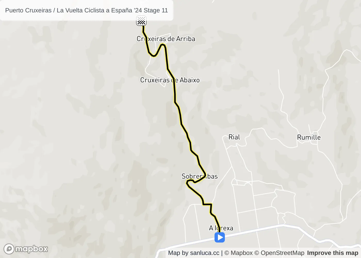
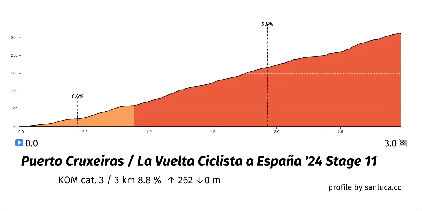
Puerto Cruxeiras is a KOM cat. 3 climb, which starts at 155.7 km (10.8 km to go) and ends at 158.6 km (7.8 km to go). It has total distance of 3 km, and an average gradient of 8.8%, going from 50 to 312 meters of altitude.
Narrow Road
Narrow Road is a narrow_road at 155.9 km (10.6 km to go).
Speed Bump
Speed Bump is a speed_bump at 159 km (7.5 km to go).
Speed Bump
Speed Bump is a speed_bump at 159 km (7.5 km to go).
Tunnel
Tunnel is a d_tunnel at 163 km (3.5 km to go).
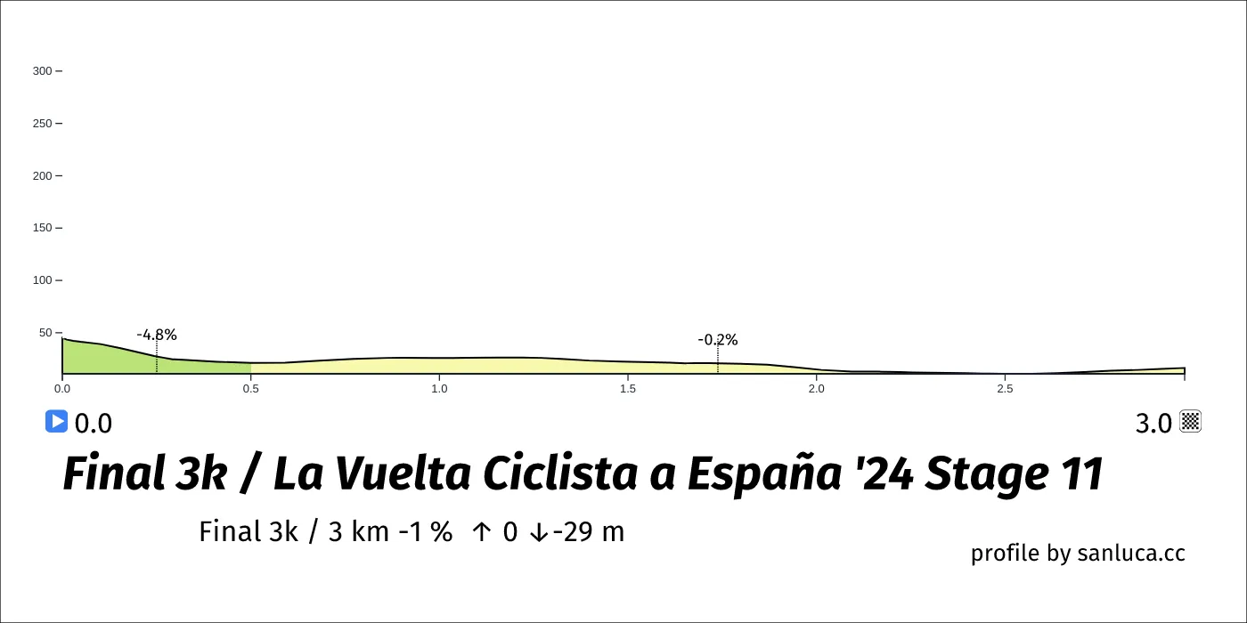
Final 3k
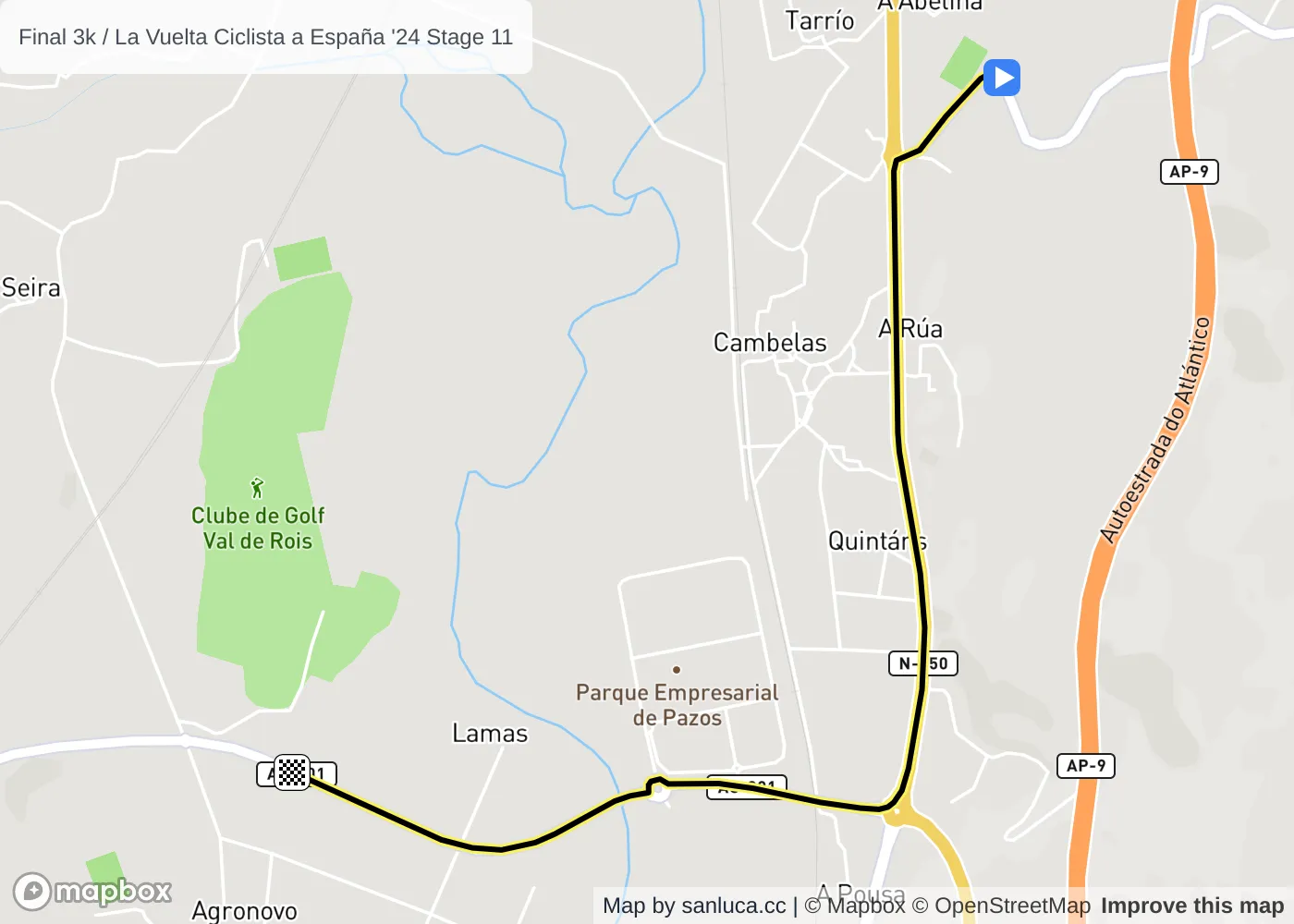
The final 3 km for this stage starts at 163.5 km, has an average gradient of -1%, and reaching 16 m of altitude.
Round About
Round About is a d_round_about at 163.8 km (2.7 km to go).
Round About
Round About is a d_round_about at 165.1 km (1.3 km to go).
Bridge
Bridge is a d_bridge at 165.3 km (1.2 km to go).
Round About
Round About is a d_round_about at 165.6 km (0.9 km to go).
Bridge
Bridge is a d_bridge at 165.7 km (0.8 km to go).
