Sunday 29 September 2024 at 08:40
UCI Cycling World Championships - Road '24 / Men Elite Road Race
Winterthur - Zurich
Classification: CM - Category CM
The race
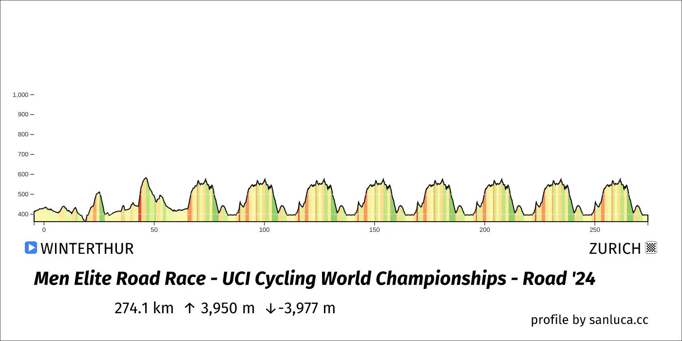
The Men Elite Road Race of the 2024 UCI Cycling World Championships - Road is a hilly race that will take place on Sunday 29 September 2024 at 08:40.The race starts in Winterthur and finishes in Zurich. Start time is 08:40 with an expected finish at 15:02 (average speed of 43 km/h).
The total distance of the race is 274.1 km. The race includes 10 categorized climbs and 0 intermediate sprints. The race has a total elevation gain of 3949.8 m with the highest altitude of the race being 684 m. The total descent of the race is -3976.7 m.
Weather and forecast
No weather data available
Points of interest
The race includes 10 categorized climbs and 0 intermediate sprints.
Neutral start
The neutral start for this race is 4.5 km long with an average gradient of 0.6%.
Descent
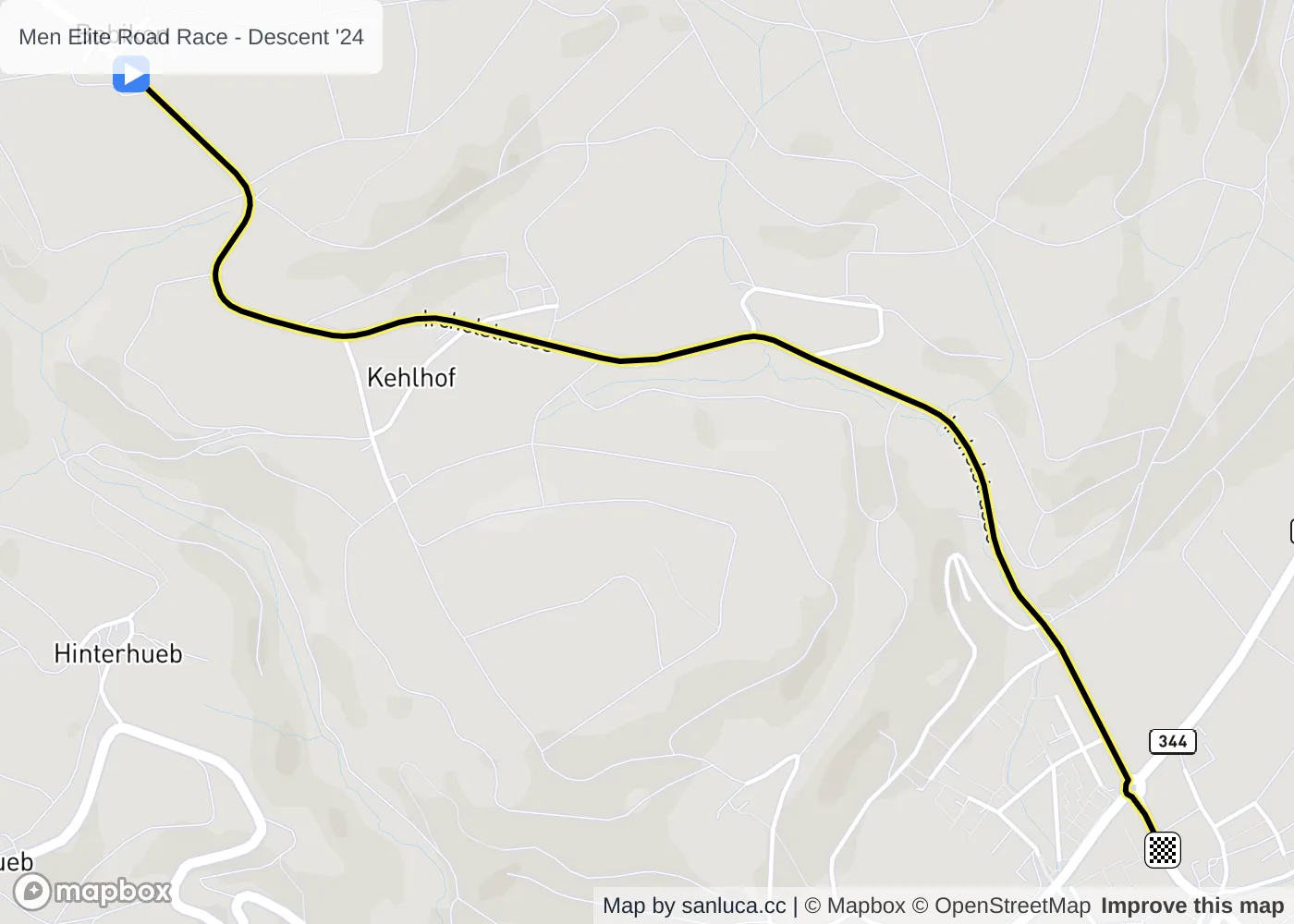
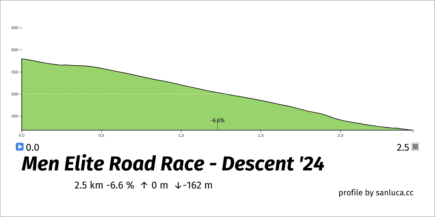
Descent is a Descent climb, which starts at 25.1 km (248.9 km to go) and ends at 27.6 km (246.5 km to go). It has total distance of 0 km, and an average gradient of 16.3%, going from 580 to 418 meters of altitude.
Descent
Descent is a Descent climb, which starts at 46.3 km (227.7 km to go) and ends at 50.9 km (223.2 km to go). It has total distance of 0 km, and an average gradient of 17.7%, going from 684 to 508 meters of altitude.
Descent
Descent is a Descent climb, which starts at 76.5 km (197.6 km to go) and ends at 79.4 km (194.7 km to go). It has total distance of 0 km, and an average gradient of 3.5%, going from 622 to 427 meters of altitude.
Descent
Descent is a Descent climb, which starts at 103.3 km (170.7 km to go) and ends at 106.2 km (167.8 km to go). It has total distance of 0 km, and an average gradient of 3.5%, going from 622 to 427 meters of altitude.
Descent
Descent is a Descent climb, which starts at 130.2 km (143.8 km to go) and ends at 133.1 km (140.9 km to go). It has total distance of 0 km, and an average gradient of 3.5%, going from 622 to 427 meters of altitude.
Descent
Descent is a Descent climb, which starts at 157.1 km (117 km to go) and ends at 160 km (114.1 km to go). It has total distance of 0 km, and an average gradient of 3.5%, going from 622 to 427 meters of altitude.
Descent
Descent is a Descent climb, which starts at 184 km (90.1 km to go) and ends at 186.9 km (87.2 km to go). It has total distance of 0 km, and an average gradient of 3.5%, going from 622 to 427 meters of altitude.
Descent
Descent is a Descent climb, which starts at 210.8 km (63.2 km to go) and ends at 213.7 km (60.3 km to go). It has total distance of 0 km, and an average gradient of 3.5%, going from 622 to 427 meters of altitude.
Descent
Descent is a Descent climb, which starts at 237.7 km (36.3 km to go) and ends at 240.6 km (33.4 km to go). It has total distance of 0 km, and an average gradient of 3.5%, going from 622 to 427 meters of altitude.
Descent
Descent is a Descent climb, which starts at 264.6 km (9.5 km to go) and ends at 267.5 km (6.6 km to go). It has total distance of 0 km, and an average gradient of 3.5%, going from 622 to 427 meters of altitude.
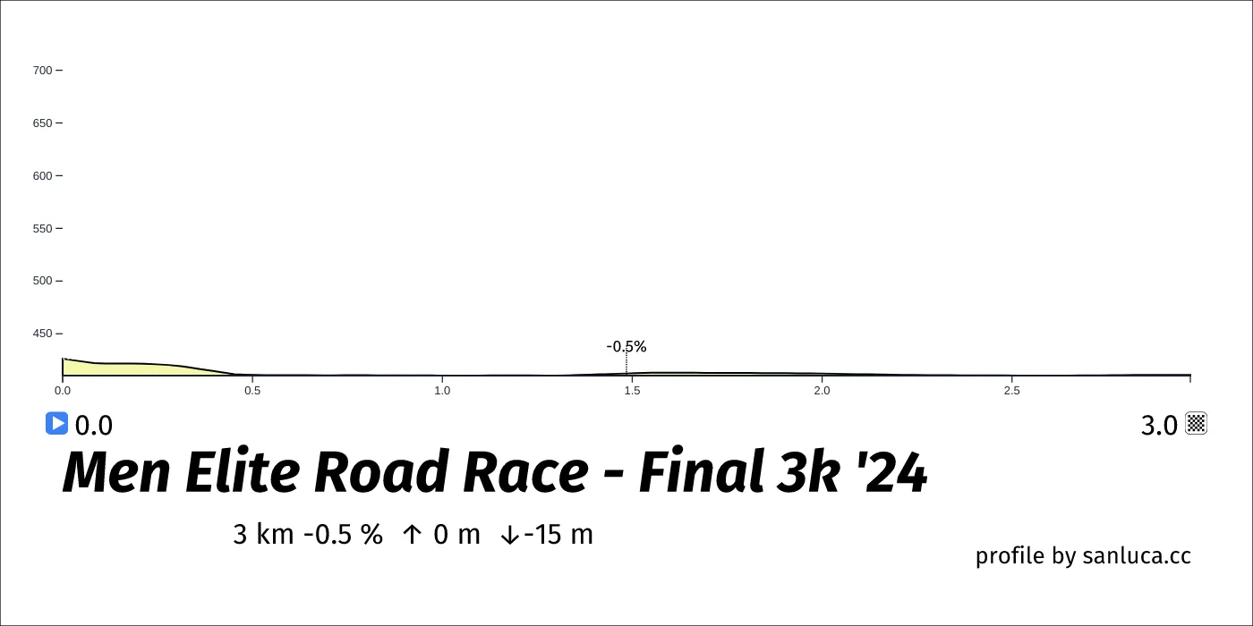
Final 3k
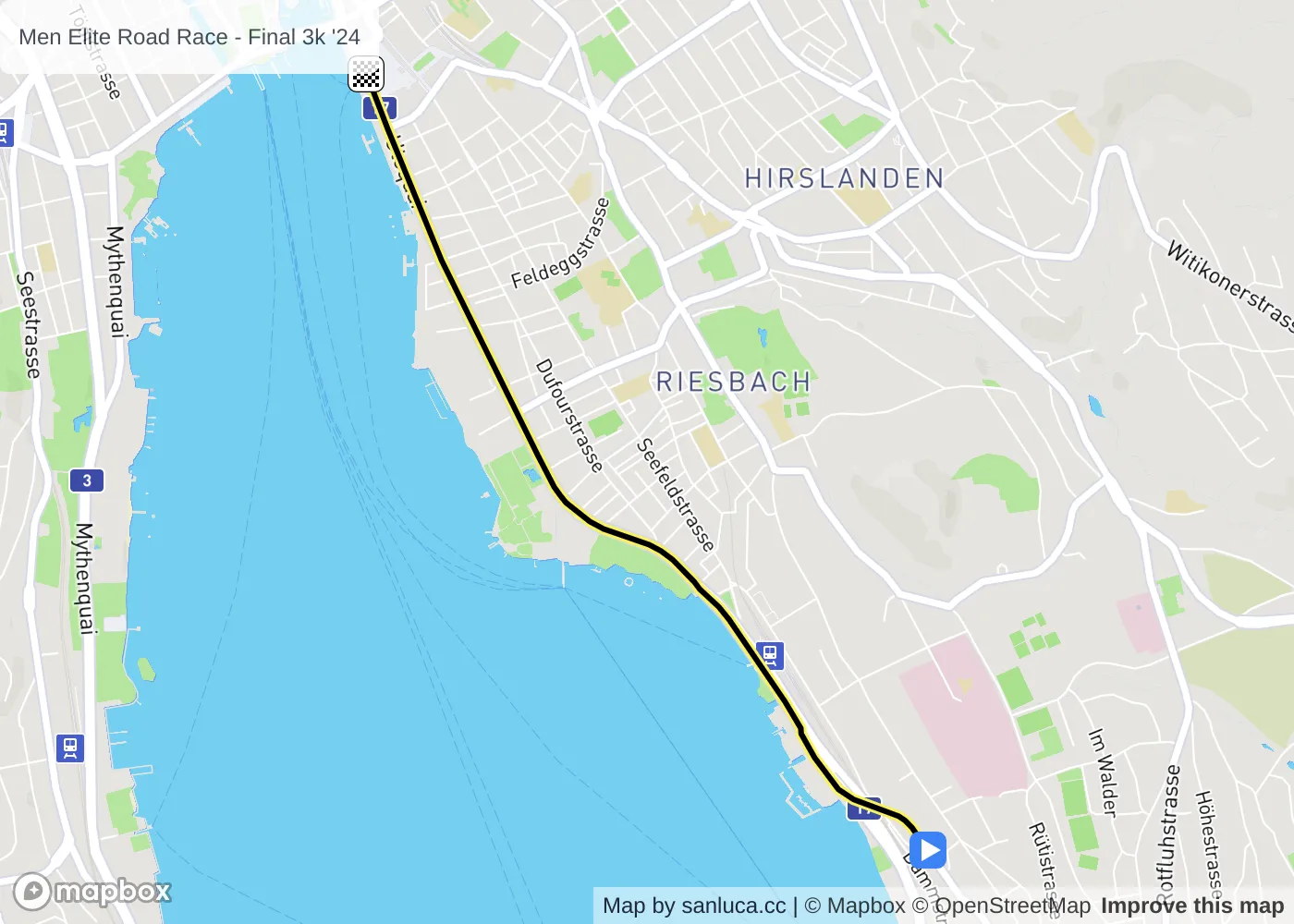
The final 3 km for this race starts at 271.1 km, has an average gradient of -0.5%, and reaching 411 m of altitude.

