Wednesday 12 July 2023 at 11:25
Tour de France '23 / Stage 11
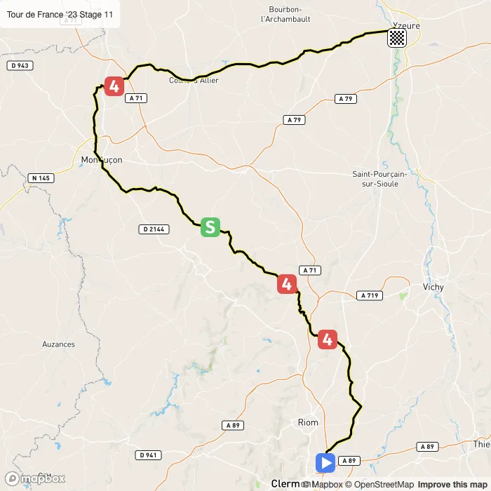
Clermont-Ferrand - Moulins
Classification: 2.UWT - Category ME
The stage
Stage 11 of the 2023 Tour de France is a lumpy stage that will take place on Wednesday 12 July 2023 at 11:25.The stage starts in Clermont-Ferrand and finishes in Moulins. Start time is 11:25 with an expected finish at 15:29 (average speed of 44 km/h).
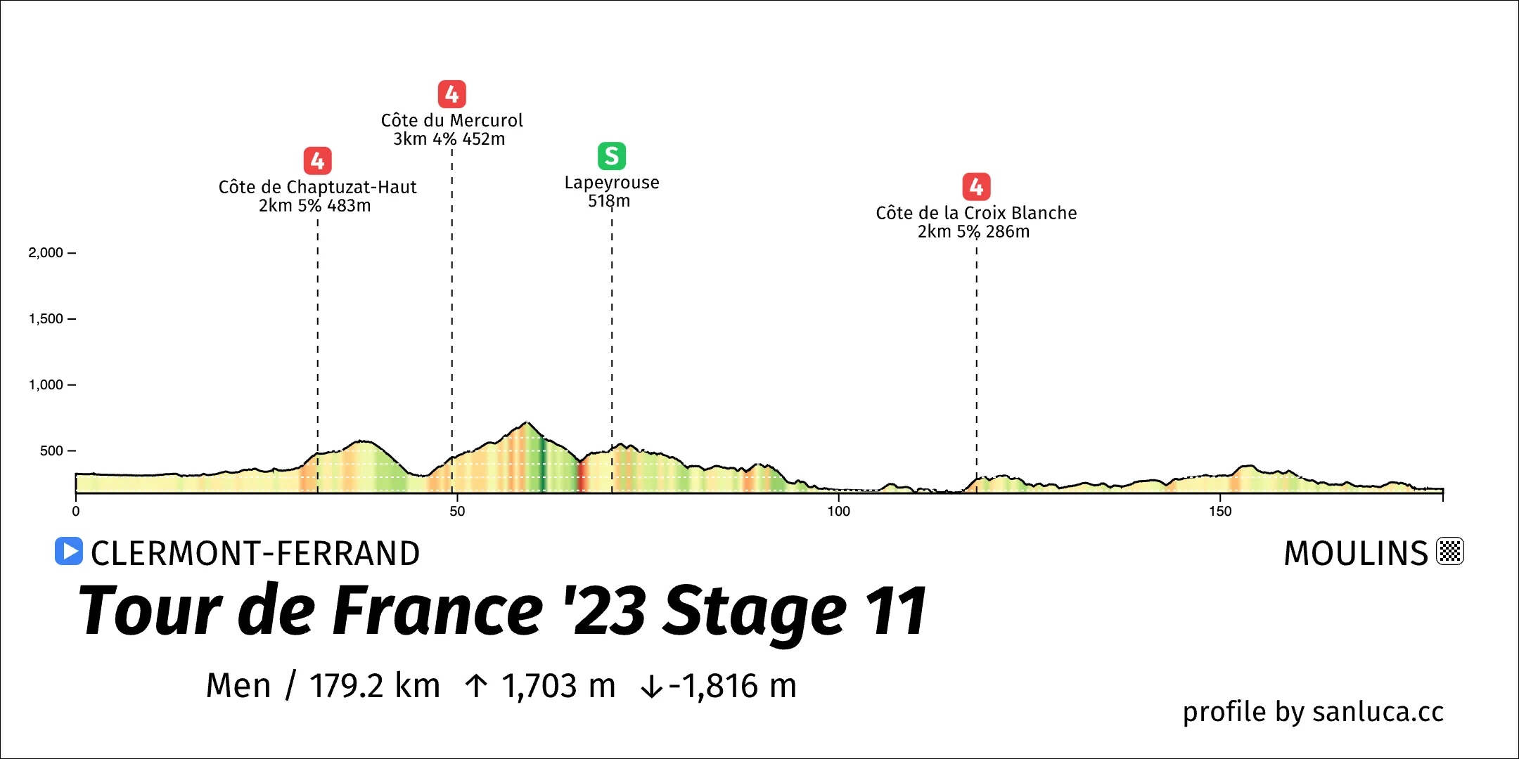
The total distance of the stage is 179.2 km. The stage includes 3 categorized climbs and 1 intermediate sprint. The stage has a total elevation gain of 1702.9 m with the highest altitude of the stage being 720 m. The total descent of the stage is -1815.9 m.
Weather and forecast
- The race will have temperatures between 21 and 25°C, with an average of 23°C.
- No rain is expected.
- The wind will come mainly from E, N, NW, W with an average of 15 km/h wind. The maximum wind speed will be 23 km/h with gusts of up to 42 km/h.
Points of interest
The stage includes 3 categorized climbs and 1 intermediate sprint.
Côte de Chaptuzat-Haut
Côte de Chaptuzat-Haut is a KOM cat. 4 climb, which starts at 29.7 km (149.5 km to go) and ends at 31.7 km (147.5 km to go). It has total distance of 1.9 km, and an average gradient of 4.8%, going from 390 to 483 meters of altitude.
Côte du Mercurol
Côte du Mercurol is a KOM cat. 4 climb, which starts at 46.4 km (132.8 km to go) and ends at 49.3 km (129.9 km to go). It has total distance of 2.9 km, and an average gradient of 4.5%, going from 323 to 452 meters of altitude.
Lapeyrouse
Lapeyrouse is a Sprint at 70.3 km (108.9 km to go).
Côte de la Croix Blanche
Côte de la Croix Blanche is a KOM cat. 4 climb, which starts at 116.5 km (62.7 km to go) and ends at 118.1 km (61.1 km to go). It has total distance of 1.6 km, and an average gradient of 5.4%, going from 200 to 286 meters of altitude.


