Thursday 22 August 2024 at 10:59
La Vuelta Ciclista a España '24 / Stage 6
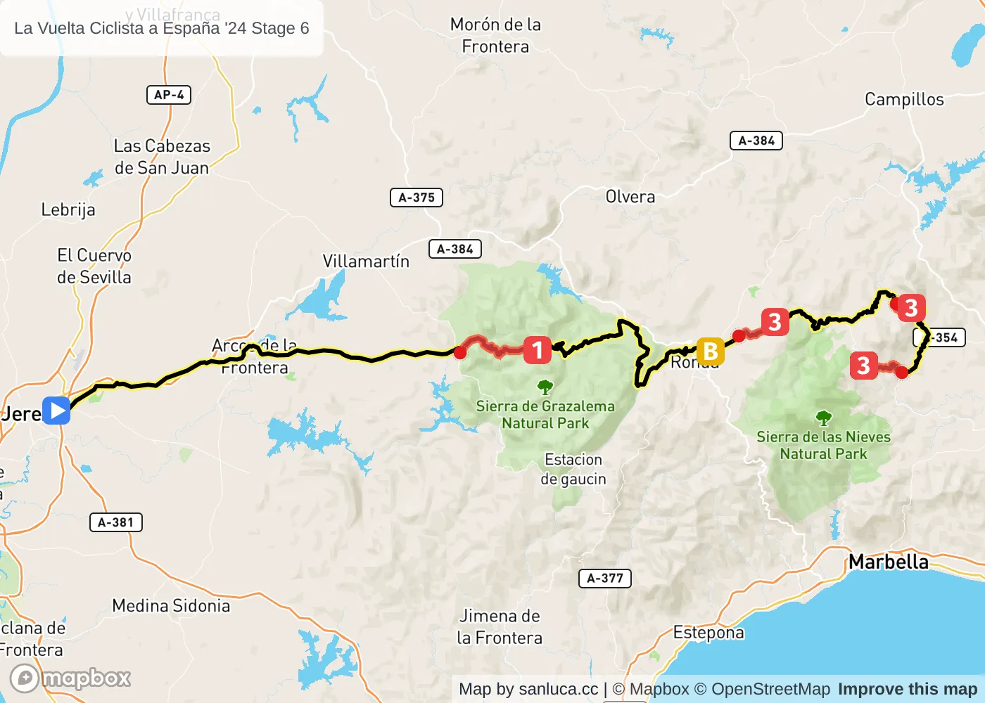
Carrefour Jerez Sur. Jerez de la Frontera - Yunquera
Classification: 2.UWT - Category ME
The stage
Stage 6 of the 2024 La Vuelta Ciclista a España is a hilly stage that will take place on Thursday 22 August 2024 at 10:59.The stage starts in Carrefour Jerez Sur. Jerez de la Frontera and finishes in Yunquera. Start time is 10:59 with an expected finish at 15:30 (average speed of 41 km/h).
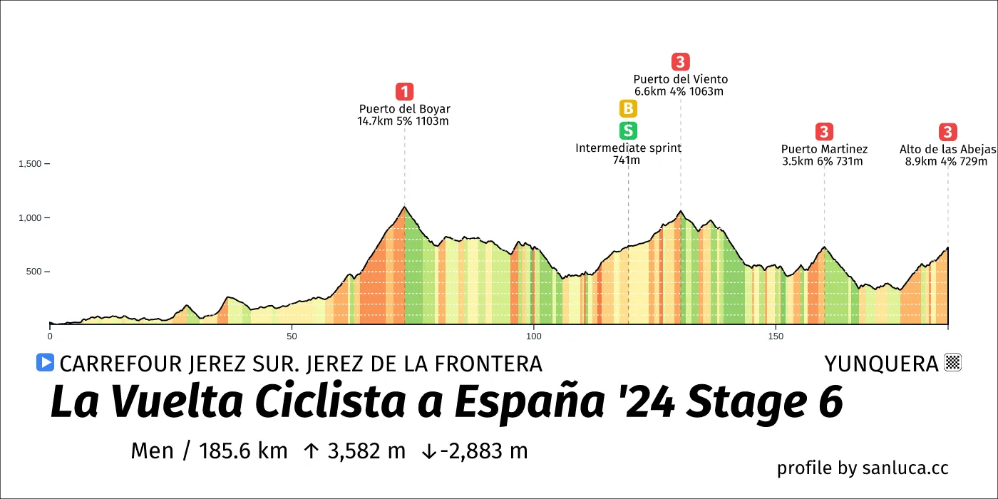
The total distance of the stage is 185.6 km. The stage includes 4 categorized climbs and 1 intermediate sprint. The stage has a total elevation gain of 3581.7 m with the highest altitude of the stage being 1103 m. The total descent of the stage is -2883.4 m.
Weather and forecast
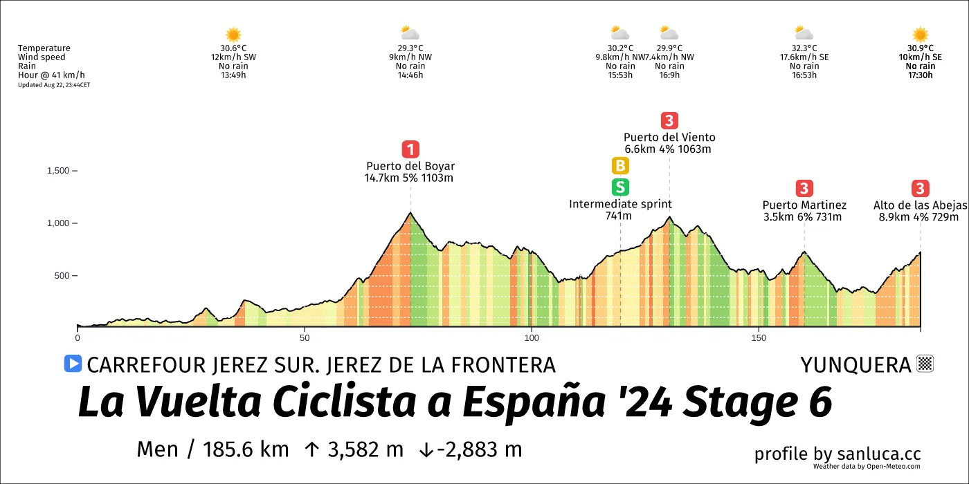
- The race will have temperatures between 28 and 34°C, with an average of 31°C.
- No rain is expected.
- The wind will come mainly from SW, W, NW, N, NE, SE, S, E with an average of 12 km/h wind. The maximum wind speed will be 21 km/h with gusts of up to 44 km/h.
Points of interest
The stage includes 4 categorized climbs and 1 intermediate sprint.
Round About
Round About is a d_round_about at 0.9 km (184.7 km to go).
Bridge
Bridge is a d_bridge at 1 km (184.6 km to go).
Bridge
Bridge is a d_bridge at 2.7 km (182.9 km to go).
Round About
Round About is a d_round_about at 6.4 km (179.2 km to go).
Round About
Round About is a d_round_about at 9 km (176.6 km to go).
Round About
Round About is a d_round_about at 9.2 km (176.4 km to go).
Round About
Round About is a d_round_about at 14.5 km (171.1 km to go).
Round About
Round About is a d_round_about at 16.2 km (169.4 km to go).
Narrow Road
Narrow Road is a narrow_road at 16.3 km (169.3 km to go).
Round About
Round About is a d_round_about at 16.5 km (169.1 km to go).
Narrow Road
Narrow Road is a narrow_road at 16.6 km (169 km to go).
Round About
Round About is a d_round_about at 17.1 km (168.5 km to go).
Narrow Road
Narrow Road is a narrow_road at 21.9 km (163.7 km to go).
Information
Information is a info at 22.8 km (162.8 km to go).
Round About
Round About is a d_round_about at 26.9 km (158.7 km to go).
Round About
Round About is a d_round_about at 27.2 km (158.4 km to go).
Round About
Round About is a d_round_about at 27.7 km (157.9 km to go).
Round About
Round About is a d_round_about at 28 km (157.6 km to go).
Round About
Round About is a d_round_about at 28.4 km (157.2 km to go).
Round About
Round About is a d_round_about at 29 km (156.6 km to go).
Round About
Round About is a d_round_about at 29.4 km (156.2 km to go).
Traffic Island
Traffic Island is a traffic_island at 30.3 km (155.3 km to go).
Traffic Island
Traffic Island is a traffic_island at 31 km (154.6 km to go).
Bridge
Bridge is a d_bridge at 31.1 km (154.5 km to go).
Round About
Round About is a d_round_about at 31.3 km (154.3 km to go).
Round About
Round About is a d_round_about at 32.5 km (153.1 km to go).
Traffic Island
Traffic Island is a traffic_island at 57.3 km (128.3 km to go).
Round About
Round About is a d_round_about at 57.5 km (128.1 km to go).
Narrow Road
Narrow Road is a narrow_road at 57.8 km (127.8 km to go).
Traffic Island
Traffic Island is a traffic_island at 57.9 km (127.7 km to go).
Puerto del Boyar
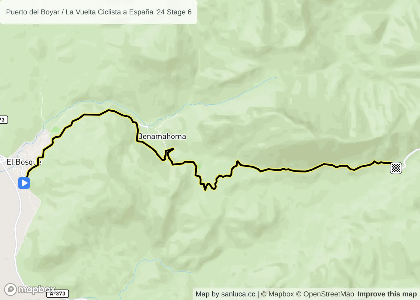
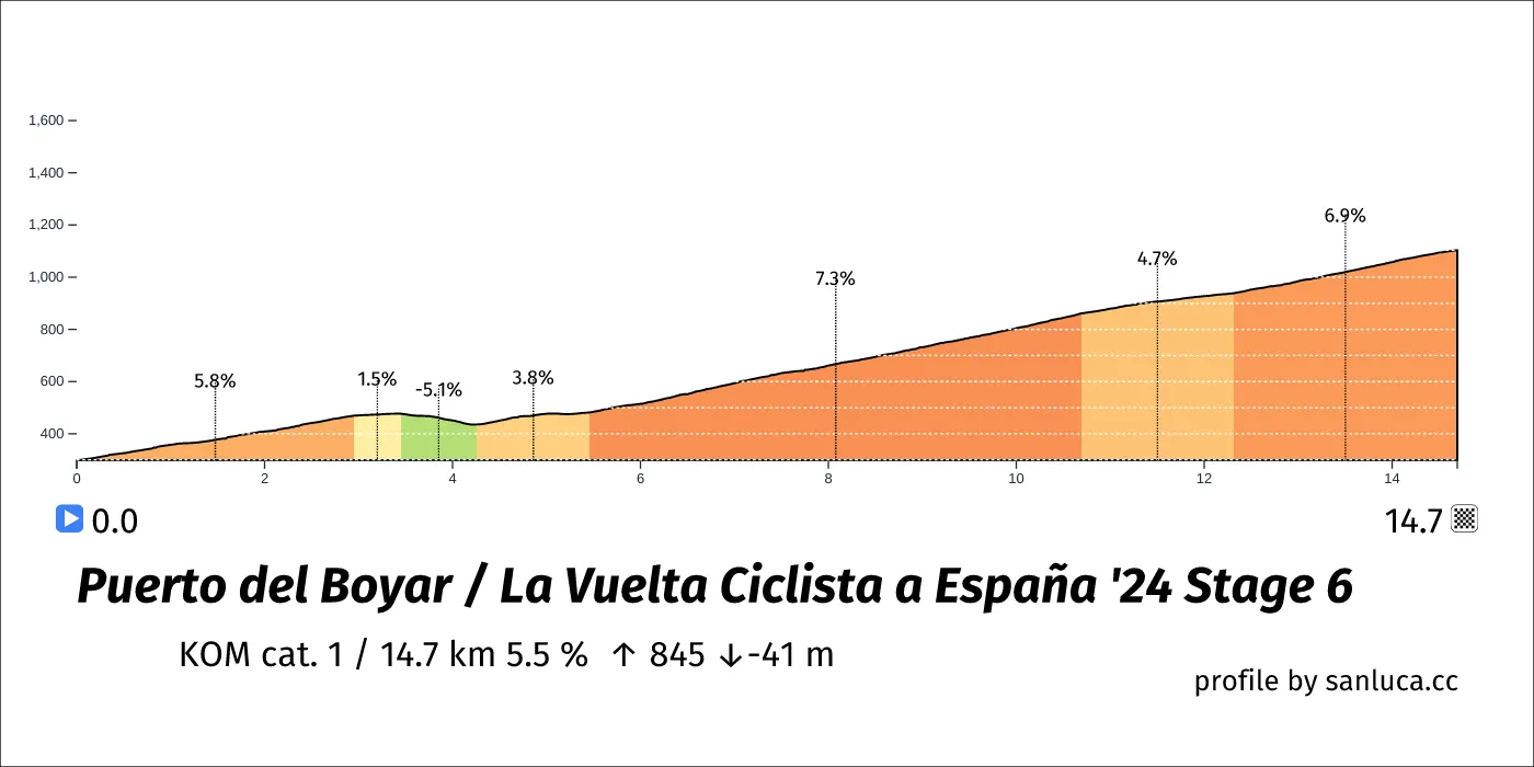
Puerto del Boyar is a KOM cat. 1 climb, which starts at 58.6 km (127 km to go) and ends at 73.3 km (112.3 km to go). It has total distance of 14.7 km, and an average gradient of 5.5%, going from 299 to 1103 meters of altitude.
Narrow Road
Narrow Road is a narrow_road at 58.6 km (127 km to go).
Narrow Road
Narrow Road is a narrow_road at 64.3 km (121.3 km to go).
Information
Information is a info at 73.4 km (112.2 km to go).
Tunnel
Tunnel is a d_tunnel at 76 km (109.6 km to go).
Narrow Road
Narrow Road is a narrow_road at 77.5 km (108.1 km to go).
Speed Bump
Speed Bump is a speed_bump at 77.9 km (107.7 km to go).
Bridge
Bridge is a d_bridge at 79.8 km (105.9 km to go).
Traffic Island
Traffic Island is a traffic_island at 93.8 km (91.8 km to go).
Narrow Road
Narrow Road is a narrow_road at 95.1 km (90.5 km to go).
D. Left Turn
D. Left Turn is a d_turn_left at 99.3 km (86.3 km to go).
Information
Information is a info at 102.2 km (83.4 km to go).
Narrow Road
Narrow Road is a narrow_road at 103.9 km (81.7 km to go).
Narrow Road
Narrow Road is a narrow_road at 104.1 km (81.5 km to go).
Bridge
Bridge is a d_bridge at 105.8 km (79.8 km to go).
Bridge
Bridge is a d_bridge at 112 km (73.6 km to go).
Narrow Road
Narrow Road is a narrow_road at 116.3 km (69.4 km to go).
Bridge
Bridge is a d_bridge at 118.4 km (67.2 km to go).
Intermediate sprint
Intermediate sprint is a Bonus sprint at 119.5 km (66.1 km to go).
Intermediate sprint
Intermediate sprint is a Sprint at 119.5 km (66.1 km to go).
Puerto del Viento
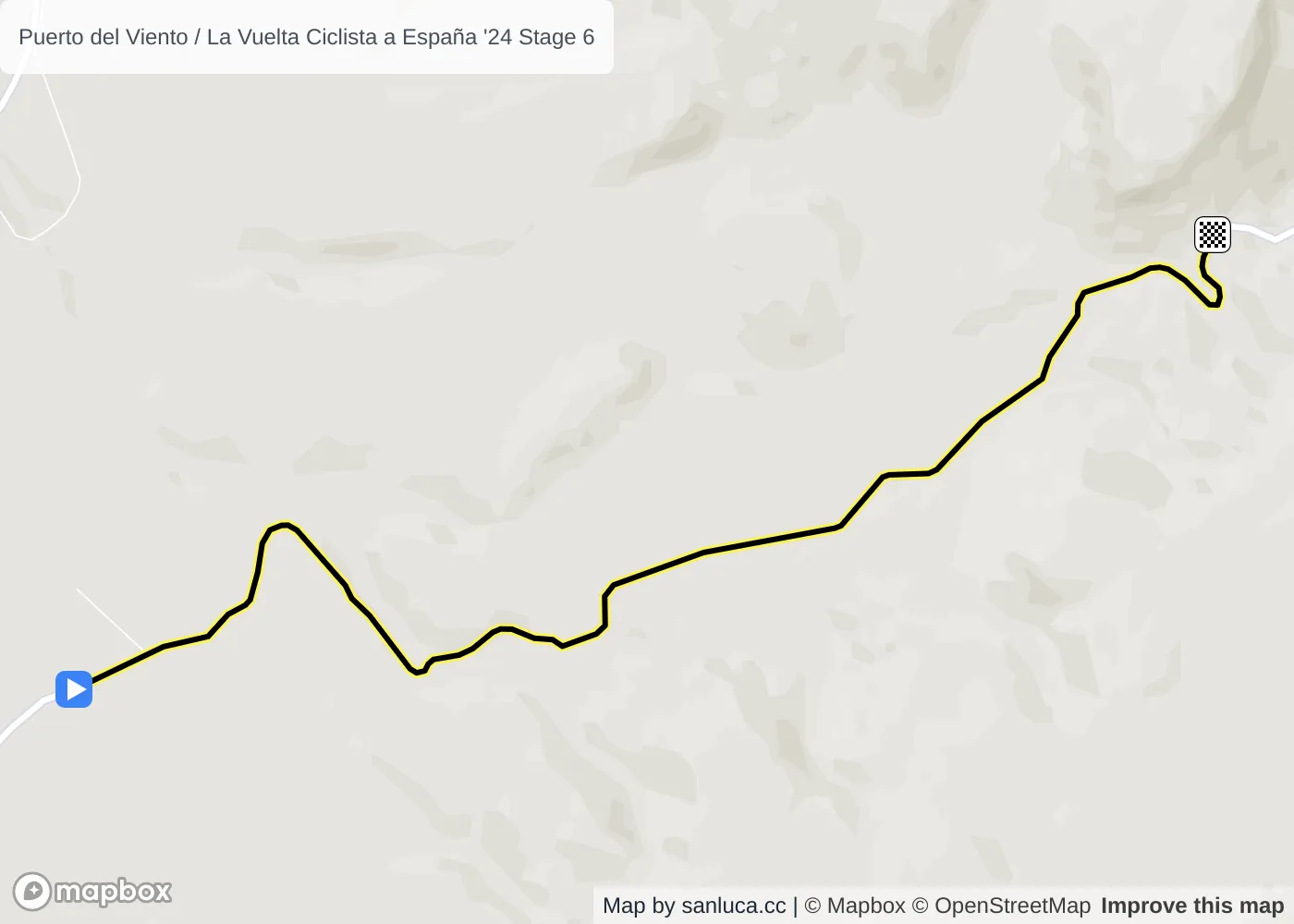
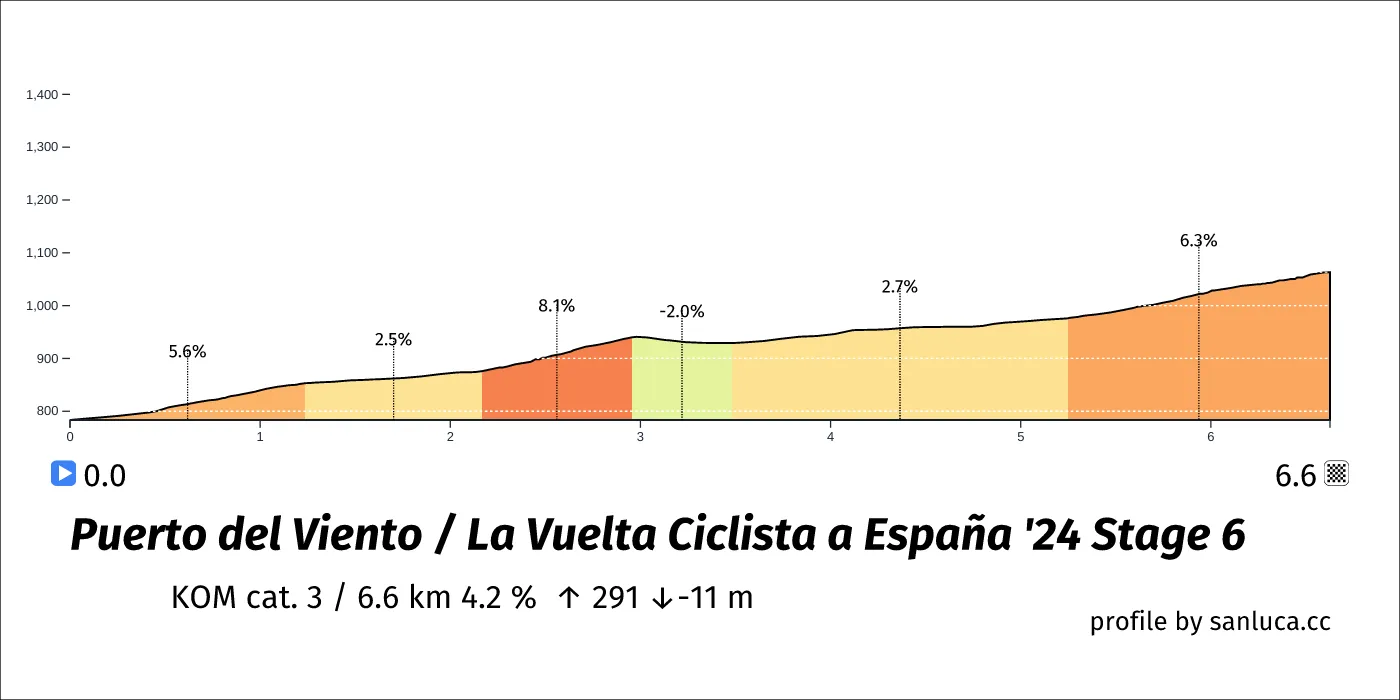
Puerto del Viento is a KOM cat. 3 climb, which starts at 123.7 km (61.9 km to go) and ends at 130.4 km (55.2 km to go). It has total distance of 6.6 km, and an average gradient of 4.2%, going from 783 to 1063 meters of altitude.
Narrow Road
Narrow Road is a narrow_road at 129.1 km (56.5 km to go).
Information
Information is a info at 130.4 km (55.2 km to go).
Information
Information is a info at 138.4 km (47.2 km to go).
Bridge
Bridge is a d_bridge at 139.7 km (45.9 km to go).
Narrow Road
Narrow Road is a narrow_road at 143.7 km (41.9 km to go).
Traffic Island
Traffic Island is a traffic_island at 144 km (41.6 km to go).
Round About
Round About is a d_round_about at 144.1 km (41.5 km to go).
Narrow Road
Narrow Road is a narrow_road at 144.2 km (41.4 km to go).
D. Left Turn
D. Left Turn is a d_turn_left at 144.3 km (41.3 km to go).
Narrow Road
Narrow Road is a narrow_road at 144.6 km (41 km to go).
Warning
Warning is a warning at 145 km (40.6 km to go).
Bridge
Bridge is a d_bridge at 148.9 km (36.7 km to go).
Traffic Island
Traffic Island is a traffic_island at 152.8 km (32.8 km to go).
Puerto Martinez
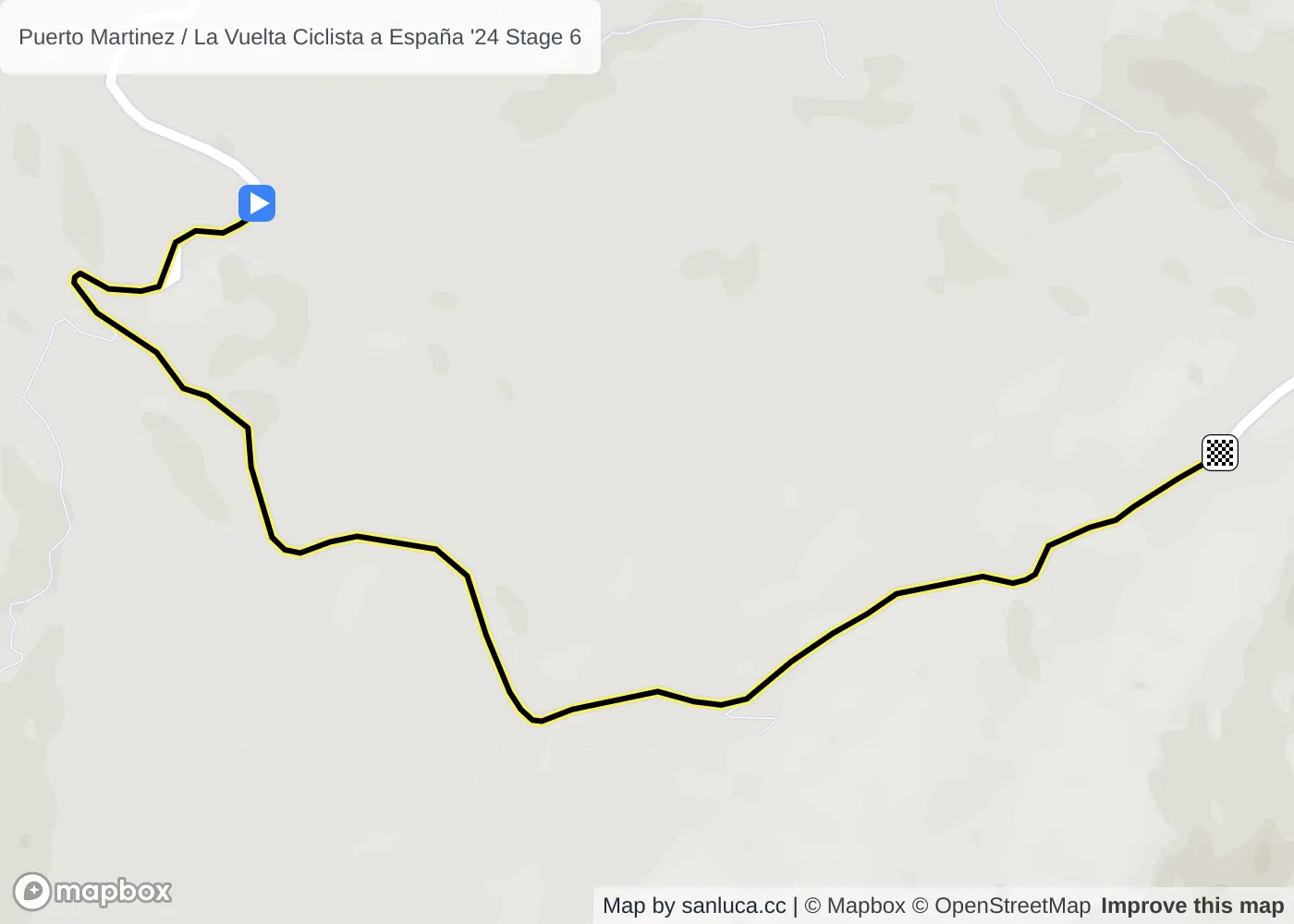
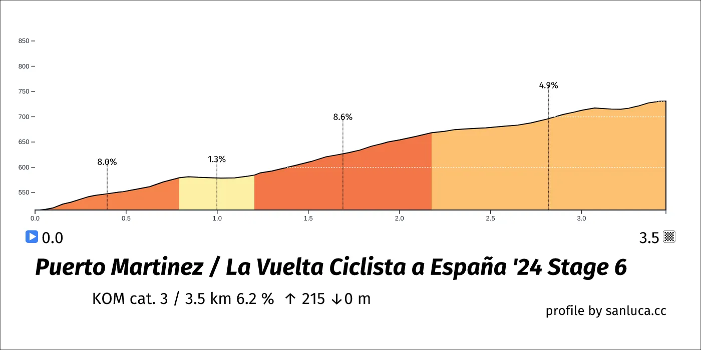
Puerto Martinez is a KOM cat. 3 climb, which starts at 156.6 km (29 km to go) and ends at 160 km (25.6 km to go). It has total distance of 3.5 km, and an average gradient of 6.2%, going from 516 to 731 meters of altitude.
Bridge
Bridge is a d_bridge at 165.1 km (20.5 km to go).
Traffic Island
Traffic Island is a traffic_island at 168 km (17.6 km to go).
Bridge
Bridge is a d_bridge at 169.7 km (15.9 km to go).
Bridge
Bridge is a d_bridge at 171.4 km (14.2 km to go).
Bridge
Bridge is a d_bridge at 173.6 km (12 km to go).
Bridge
Bridge is a d_bridge at 176.1 km (9.5 km to go).
Bridge
Bridge is a d_bridge at 176.2 km (9.4 km to go).
Round About
Round About is a d_round_about at 176.7 km (8.9 km to go).
Alto de las Abejas
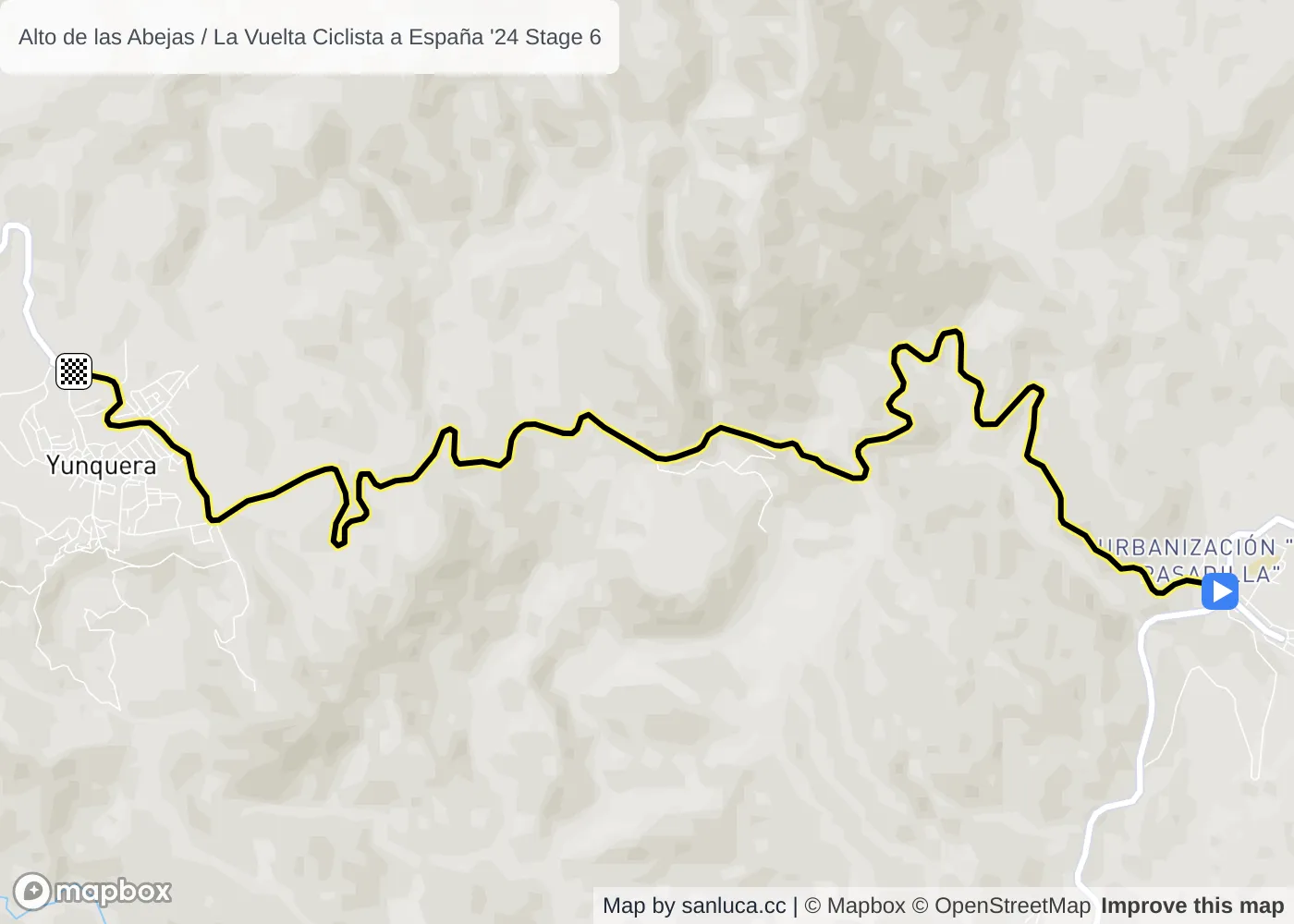
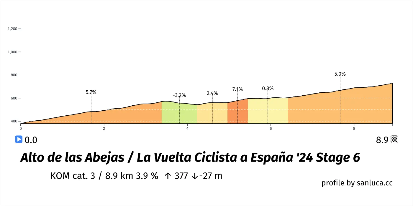
Alto de las Abejas is a KOM cat. 3 climb, which starts at 176.7 km (8.9 km to go) and ends at 185.6 km (0 km to go). It has total distance of 8.9 km, and an average gradient of 3.9%, going from 380 to 729 meters of altitude.
Bridge
Bridge is a d_bridge at 180.9 km (4.7 km to go).
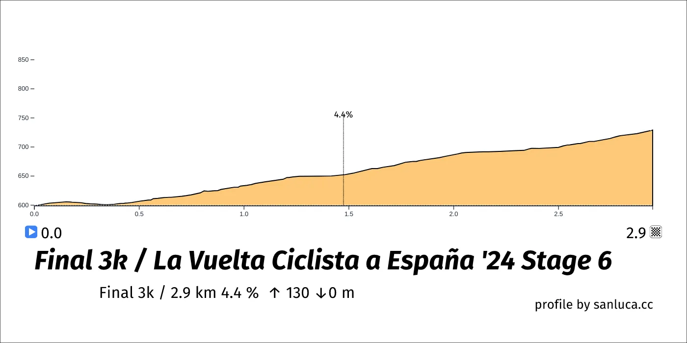
Final 3k
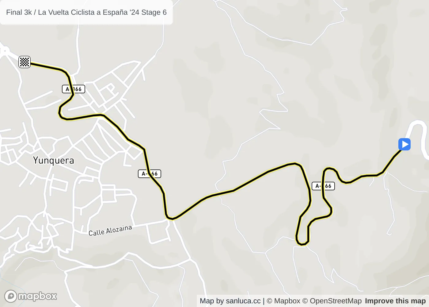
The final 3 km for this stage starts at 182.7 km, has an average gradient of 4.4%, and reaching 729 m of altitude.
Speed Bump
Speed Bump is a speed_bump at 184.9 km (0.7 km to go).
Traffic Island
Traffic Island is a traffic_island at 185 km (0.6 km to go).
Traffic Island
Traffic Island is a traffic_island at 185.1 km (0.5 km to go).
